Tourist First

Travel notes and advice from around the world. Above, the daily flight from Managua at the San Carlos, Nicaragua, airstrip.

Tuesday, December 23, 2014

Peru: Don't Skip Ollantaytambo

This is a bath, still with running water, dating to the Inca era.
 In the background you can see the beginning of terraces that
rise high above the town of Ollantaytambo.
     
       This small town (population 3,000) is more or less the end of the road for people traveling from Cusco to Machu Picchu.  If you make it to Ollantaytambo by car or bus, this is where you transfer to a train because there is no road connection to Machu Picchu. Oddly, hiking from here isn't an official option.  None of the established trails --  the classic Inca trail, the Salcantay trail and the Inca jungle trail -- go through Ollantaytambo, and simply walking along the railroad track isn't an approved route.
          Many visitors take a train all the way from Cusco to Aguas Calientes (the town at the foot of Machu Picchu), giving them at best a quick glimpse at this town's Inca-era ruins, which are considered second only to Machu Picchu in grandeur and have more historic significance. Ollantaytambo is worth much more than a glance from a moving train.
          The town, pronounced oh-yay-tay-TAHM-bo, predates the Inca culture.  Some of the ruins that overlook the town were built by the Quillques, who were living here in 1440 when the great Inca empire-builder Pachacutec conquered it and started building a ceremonial center and a royal compound with an estimated 1,000 workers. Others may have been built by the Colla people of Lake Titicaca, brought here to work by Pachacutec. Time ran out on the Inca's rule before his buildings were complete. In the mid-1530s, the ruling Inca, Manco Inca, transformed Pachacutec's incomplete temple complex into a fortress and from it was able to defeat a 100-strong Spanish force led by the Pizzaro brothers, Hernando, Juan and Francisco. It was the last defeat for the Spanish, the last victory for the indigenous people.
         In addition to the ruins, the town itself provides testimony to the past.  Many buildings consist of adobe, brick or stone walls built atop lower walls dating to the Inca era or earlier. Ancient water channels still provide drainage, testimony to the native peoples' genius in managing water.
Terraces and fortifications rise above corn fields and climb
 the mountains that surround Ollantaytambo. 

Photos below: Stairs connect the terraces.

Like most Inca-era stone work, the walls at Ollantaytambo sit directly on
bedrock.  The smaller stones appear to be a rather unartful repair. Notice
the lack of mortar between the larger stones. 

Unlike Machu Picchu, most of what visitors see at Ollantaytambo is original
stonework. Few areas show signs of repairs.
Six giant slabs of pink rhyolite are perfectly slotted together
 and oriented to glow at sunrise in Ollantaytambo's never-finished
 sun temple. The long straight lines  and the use of molten bronze to hold 
the wall  together are unusual and not seen in sun temples elsewhere.
This throne-like carved stone sits among many rough-carved
 stones near the sun temple. Its purpose and intended

 location are, like most of Inca culture, lost to the ages.
The terraces are the most striking feature of the Ollantaytambo ruins. Similar
terraces can be seen in many areas of the Andes in Peru.


A narrow path takes people who don't suffer from vertigo from
one section of the fortress to another. On the opposite moutain,
Ollantaytambo's famous granaries -- grain storehouses --  and the trail
that leads to them are visible. We did not visit those ruins.

A restored structure clings to the side of the mountain
overlooking Ollantaytambo. Thatched roofs were
commonly used by pre-Columbian cultures in Peru.

Water rushes through a centuries-old channel to
feed Inca-era fountains and baths.

This small street in Ollantaytambo may predate the 1440 Inca
conquest of the town, but the lower stones on the walls sure
look like Inca stone work to my eye: the stones interlock in
various ways, walls appear to tilt slightly inward, and there's
little or no visible mortar. Below are some more street scenes
from this remarkable place. 


Note the water channeled along this street. 


Thursday, December 18, 2014

Peru: Machu Picchu, the Inca's Mountain Getaway?

This famous view, from the caretaker's hut (also called the guardhouse), requires climbing
stone steps near the entrance to Machu Picchu. The largest green area is called the principal
plaza. The mountain in the background is Huayna Picchu (also spelled Waynapicchu).
About halfway up and on the other side of Huayna Picchu is the Moon Temple. A number of
visitors climb to the top of Huayna Picchu as part of their Machu Picchu visit. We paid for
this extra activity but then gave up before we made it down from Machu Picchu and without
even reaching the base of the other other mountain. If we had pressed on, we would have
found the trail to the Moon Temple closed and would have been caught on the mountain
in a heavy rain.  Sometimes wimping out is the smart thing to do.


Machu Picchu wasn't exactly an afterthought on our fall 2014 trip to Peru, but it wasn't the focus, either.  Jane and I started out looking for an Amazon River cruise, which is described in an earlier post, and then looked at what else we could do in Peru.  To get to Machu Picchu, we flew from Lima to Cusco, where we went straight from the airport to Ollantaytambo, which is about as close to Machu Picchu as you can get by road.  From there it's  a train to Aguas Calientes, the town at the foot of the mountain. Many tourists take a train from Cusco all the way to Aguas Calientes and "do" Machu Picchu as a day trip out of Cusco.  From Aguas Calientes, one can take a shuttle bus to the park (Machu Picchu is a national park) entrance or spend 90 minutes or more walking up extremely steep stairs and trails. 
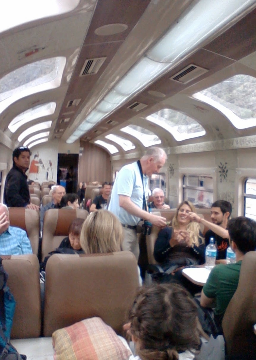
Aboard the train from
Ollantaytambo to Aguas Calientes.
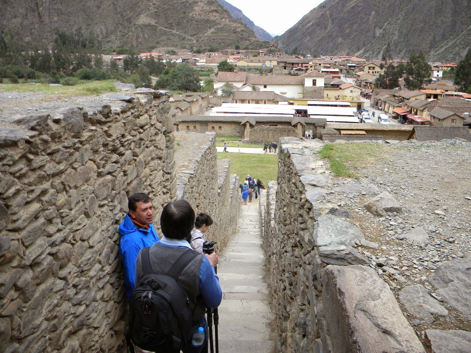
     After a couple of days exploring Ollantaytamo and its own spectacular Inca-era ruins, we took the train (a little over two hours) to Aguas Calientes, spent the night, and the next morning took the bus up the mountain. 
    I was surprised to learn that much of what we see at Machu Picchu is restored. Using the original stones, workers are gradually rebuilding this mysterious city, which was revealed to the world only in 1911 when area residents showed it to Hiram Bingham, the Yale archaeologist who was the model for the Indiana Jones movie character. What he saw was covered in jungle vegetation and much more in ruins than what we see today.  It is, however, easy to tell what is original (no visible mortar) stonework and what has been restored (visible mortar).  While no one knows for sure what this city was originally called or what its purpose was, the common assumption is that it was a winter getaway for the Inca (emperor), whose capital was Cusco, about 70 miles to the southeast and at a higher (3,400 meters) elevation than Machu Picchu (about 2,400 meters).  Machu Picchu is in a rainforest jungle. Cusco is in a desert, so winters are much milder at Machu Picchu. 
      Although the Spanish fought the Inca's forces in this area -- Ollantaytambo was the site of the last victory over the Spanish -- it seems that they never knew of it. Perhaps because it wasn't a military base, nor is its location strategic.  It overlooks the rocky and shallow Urubamba River (the river of the Sacred Valley), but the river can't accommodate even the smallest of boats. However it happened, this city died with the Inca Empire and was taken over by the jungle until Bingham came. 
      Most of what is known or thought about Machu Picchu, its buildings and their functions, is based on what archaeologists have found elsewhere, Spanish accounts of Inca-era culture, and conjecture. There's no guesswork involved, however, in appreciating the majesty of the city's location, the beauty of its structures and its harmony between nature and man.  Although there are many wonderful images of Machu Picchu, I haven't seen any that truly capture the magnificence of the place. I hope, though, that my photos provide an idea of what a visit there is like.
When the train arrives in Aguas Calientes, it puts you right in the
middle of the small mountain village.

Below: A restaurant-lined street in car-free Aguas Calientes.
The rainbow flag is the flag of Cusco. 

Machu Picchu is in Cusco province. .

This is the view upon entering Machu Picchu. 
This is called "the temple of the three windows."  Whatever
 it was meant to be, it was never completed. There are stones
 still marked and waiting to be cut for it.
This is the so-called Sacred Plaza.  The collapsing wall of the
temple is not typical of Machu Picchu. Most stone walls
have very strong and deep foundations.
Machu Picchu is extremely vertical. Anyone who hopes see much
 of the site has to go up and down a lot of steps, many of them not
in good repair. Note the collapsing wall. This one and the Sacred Plaza
wall were the only ones we noticed in such bad shape.
No one knows the meaning or purpose of this carefully carved
 stone, which occupies one of the highest points at Machu Picchu.
 Hiram Bingham gave it the name "Intihuatana," which means "place to
 which the sun was tied" in Quechua, the Inca language that
 is still one of Peru's official languages.
This is the Sacred Rock, 25 feet long, and one of the few stones
 here that visitors aren't allowed to touch.  Until a few years
 ago, however, hundreds of visitors each day would spread their
 arms on the rock "to feel its energy." Again, no one knows
 for sure what meaning it had for the people
 who built Machu Picchu.
The trail from Machu Picchu to Huayna Picchu. Stone steps make
the steep climb a good bit easier, but it's still a steep climb.
These stone houses, thought to have been used by agricultural workers, appear
 to have been restored. Mortar can be seen between some of the stones.
 

This is said to have been a royal tomb. It's
beneath the Temple of the Sun and has what
appear to be niches for mummys. Visitors are
not allowed to get closer than this to the tomb.

Many Pre-Columbian sites in Peru have fountains like this that still work.
Note the drainage channel carved into the floor.

Visitors cannot enter the Temple of the Sun. Almost every Inca site in the
Sacred Valley has a sun temple, all with features oriented to the December
 and June solstices.  This one has one window that lines up with the sunrise at the
 Sun Gate at the December solstice and another oriented to the June solstice.
 Note how the walls lean in slightly, strengthening the building's
 stability in this earthquake-prone region. In the upper left portion of
the photo you can see the Urubamba River far below. The cascading

terraces were originally used for agriculture.  
Llamas such as this probably have a pretty soft life posing
for photos near the caretaker's hut at Machu Picchu. Finding
the gentle animals there was a surprise but clearly they're
stationed there to amuse tourists. Worked for us! This was
my last Machu Picchu photo.  After spending about five
hours clambering around the site and making our abortive
attempt to climb Huayna Picchu, we headed back to the
shuttle bus, arriving just as it started to rain. Heavily.
 Though we had to stand in the rain for maybe a half hour
 before getting on a bus, we were glad we weren't at the top
 of stone stairway or trying to navigate a steep rocky trail. 


Sunday, December 14, 2014

Peru: The Past Captured in Clay


   One of the great tragedies of history, in my opinion, is that the Pre-Columbian civilizations of the Americas left no written records. What we know is often inferred from graves and other archaeological sites.  Peru, in addition to the still-standing stone walls built by the Tahuatinsuyo (Inca) empire and the cultures that preceded it, has had rich archaeological finds that have allowed scholars such as Rafael Larco to stitch together a history of the region's various cultures starting about 500 B.C.
    The discoveries have been mainly ceramic vessels created in communities along Peru's north coast and in the Andes.  The Museo Larco in Lima (click HERE for website) and the affiliated Museo de Arte Precolombino in Cusco (click HERE for website) have done brilliant jobs assembling and interpreting these vessels.  The curator notes for each piece are among the best such notes I've seen in any museum anywhere. 
     Jane and I have been taking pottery classes, so during our fall trip to Peru we were particularly interested in seeing Pre-Columbian pottery. We looked at the vessels in terms of the craftsmanship (which was amazing) and as art objects. Fortunately, both museums allowed photography. Here are some of the vessels that caught our eye. 


This piece (left) depicts a
monkey-man preparing
a body for burial.


Almost all of the portrait
 vessels, such as the one at right, are
 thought to depict specific individuals. 
 The museum in Cusco had three vessels 
said to be by different artists showing 
the same person at three different ages.

This vessel shows three dead men. The one in the middle
is masturbating.  Depictions of almost every
form of sex can be seen at the Museo Larco's erotica gallery, which
explains that some nonprocreative sex acts are thought
 to have had religious meaning.
.
A graphic depiction of childbirth. 

This reminded us of 20th-century Cubism.

We saw nothing else
 with swirls like this.
Here's a bowl that could be easily copied
by a competent potter today.


Saturday, December 13, 2014

Peru: Cruising the Amazon (and more)

     A highlight of our fall trip to Peru was a week spent aboard International Expedition's Estrella Amazonica (click HERE for website) crusing upstream from Iquitos, the world's largest city (pop. 500,000+) that cannot be reached by road -- only water (it's 2,400 miles up the Amazon from the Atlantic) or air.
The shaman, Maestro Juan, 71,
 in the village of San Jose.
     Above Iquitos, the Amazon is formed when the Ucayalli and Maranon rivers converge. We went 320 miles upstream from Iquitos to a ranger station on Rio Pacaya, a small tributary of the Ucayalli River, then back down the Ucayalli to the convergence and up the Maranon River to near the community 9 de Octubre, before returning to Iquitos.  La Estrella Amazonica traveled 680 miles on this cruise -- but we traveled more miles thanks to daily excursions up and down little tributaries on skiffs. We also visited jungle villages, were invited inside a home, and met a shaman. We learned about the shaman's extensive and difficult training, his regular use of a hallucinogenic drug, his knowledge of jungle-plant drugs, and we each received a blessing from him that involved his blowing tobacco smoke onto our hands and heads.
     Jane and I were at a disadvantage on this trip because we had brought lousy binoculars and a camera that isn't good for photographing wildlife at a distance, and most of the wildlife that we saw was far away: sloths in distant trees, toucans a few hundred yards away, iguanas hidden on high branches, etc. A new friend, Dick Greenberg of Fort Collins, Colorado, was smart enough to bring a really good camera, has a really good eye, and made a really good video of the trip.  You can see Dick's video by clicking HERE.  The music on Dick's video was played by La Estrella's band, made up of crew members. Most nights the band played during cocktail hour and by the end of the trip had everyone but the most curmudgeonly old men dancing.

Note: I usually don't update posts, but since this post was written, a cabin fire killed two guests on La Estrella Amazonica. The boat was promptly renamed Amazon Star and continued in service for a time. Now it appears that International Expeditions has stopped using that boat and has another vessel for its Amazon adventure. For my post on the fire, click HERE.

    I heartily recommend International Expeditions and La Estrella Amazonica to anyone interested in visiting Peru's Amazonian region. La Estrella, one year old when we were there, is the newest of the dozen or so such boats on the river and the only one providing private balconies to all passengers. The naturalists are first rate and fearless in reaching into the water to grab caimen so passengers can get a close look.  All meals in the large dining room were buffet-style and quite good; although some fish dish was a constant, there was a good bit of variety, including excellent ice creams. The cabins were relatively spacious with room to slide all luggage under the bed, and the shower always had good pressure and hot water.  The bartender, Vincente, made a solid pisco sour. One tip: get a cabin on the second deck as far forward as possible.  The boat motored all night for several nights and the engine noise made sleep a challenge in our cabin, which was at the rear of the second deck. We assume it was even worse on the first deck, which is closer to the boat's large Caterpillar diesel engines.
     Despite my trouble photographing wildlife, I did get a few decent snapshots that give some idea of what the experience was like. Here are some.
La Estrella Amazonica.  This was taken from one of the boat's two skiffs.  Passengers are boarding the other skiff.
 
View from the bed in our cabin. All cabins have balconies.
During a visit to a jungle village's one-room school, some of us danced with the children.
Kitchen in a jungle village house. A wooden box is filled with dirt and the fire is built on top.
Dugout canoes are still being made and used along the rivers.


A fisherman tosses walking catfish from his boat into
 a floating fish pen.  Later the entire pen and thousands of live
catfish will be floated downstream to market.

A motorized dugout canoe transports firewood. Note the "long tail" propeller.

Riverfront houses near Nauta, a market town on the Maranon River.
We hiked a bit to see these giant lily pads on a jungle pond.
This immature woodpecker had apparently fallen from its nest into the river.
One of our naturalists picked it up and put it on a branch to recover.
The Amazon basin is full of life -- and death, creating a plentiful food
 supply for black vultures such as these. Among the many kinds of vultures
were the same turkey vultures common in the eastern U.S.

Up one of the Ucayalli's many tributaries. Rain gear is essential
 but it won't keep you dry during an Amazon downpour.
We went fishing for piranha and this is the first one I caught.
 We used raw beef as bait. The fish were cleaned and  fried for dinner
 back on La Estrella.  Mostly skin, very little meat, but tasty enough.

Here's one of our naturalists taunting Jane with a bird-eating spider.
An unexpected treat was a ride (four passengers at a time) aboard a float
 plane to see the confluence of the Ucayalli and Maranon rivers
 and the beginning of the Amazon.

The Ucayalli (upper left) and the Maranon (upper right) unite here
 to create the Amazon.  Note the clouds. We were the first group to fly.
 The last group flew (and transferred between the plane
and a skiff and then to La Estrella) in a heavy rain.